Showing posts with label Sierra Nevadas. Show all posts

12.11.2016

The Rae Lakes Loop

BT on Bubbs Creek Trail

Z


Nearing the top of the pass...


Our crew atop Glenn Pass - the high point of our trip of 11,978 feet


Descending down from Glen Pass to Rae Lakes through the snow...


Descending down Paradise Valley 

We just saw a bear a few yards away from us before crossing this bridge.

Fun with fire light...


12.08.2016

At Rae Lakes

When we were hiking along the PCT/JMT in 2010, as I came across the beautiful basin of Rae Lakes, I was struck with a tinge of remorse that we couldn't take the time to spend an entire day or days or weeks at this magical high sierra playground - but we needed to get up and over Mt Whitney before running entirely out of food.  Last June I had the opportunity to return to Rae Lakes and we spent a couple nights there - watching the granite change colors during the course of the day and encouraging each other to plunge into the frigid lakes as often as we could.

gettin' into the water...


We all swam to one of the islands in this lake.

The boys were totally exhausted from our elevation gain the day before.


11.20.2015

Hike to Kern Hot Springs

Before I started working again and before the snows hit the Sierras, I drove down from the Bay Area, into the smoke-choked central valley - billowing with smoke from the biggest fire of 2015 spreading into Kings Canyon.  I drove to the seemingly infamous Mineral King trailhead in Sequoia National Park.  Peter Beckman, founder of the delicious Santa Cruz sourdough bread company of his name - who also drives a VW diesel wagon - advised me to take a cross country route (i.e. no trail) over a few high mountain masses before connecting back to a trail for my 50 mile loop to Kern Hot Springs.  

The smoke was starting to clear up the further east I pushed. Atop the first pass...


Descending to Spring Lake...

Heading up to the next pass


And later the same day from Mineral King I made it to the top of aptly-named Hands and Knees Pass.  The loose scree and lack of trail with my backpack full of food made the climb a bit sketchy but also exhilarating. 

Solo hiking means more selfies.

Next morning closer to a real trail at Little Five Lakes

wild (and delicious) sierra onion

The air was fairly clear during my hike but mid-afternoon the second day - the smoke started pouring over the 12,000 ft high mountain ridges that had been blocking the smoke in the central valley from coming up into the mountains.

Descending down into Kern Canyon...

Warm water!

the tub...and the water is dang hot from the source!


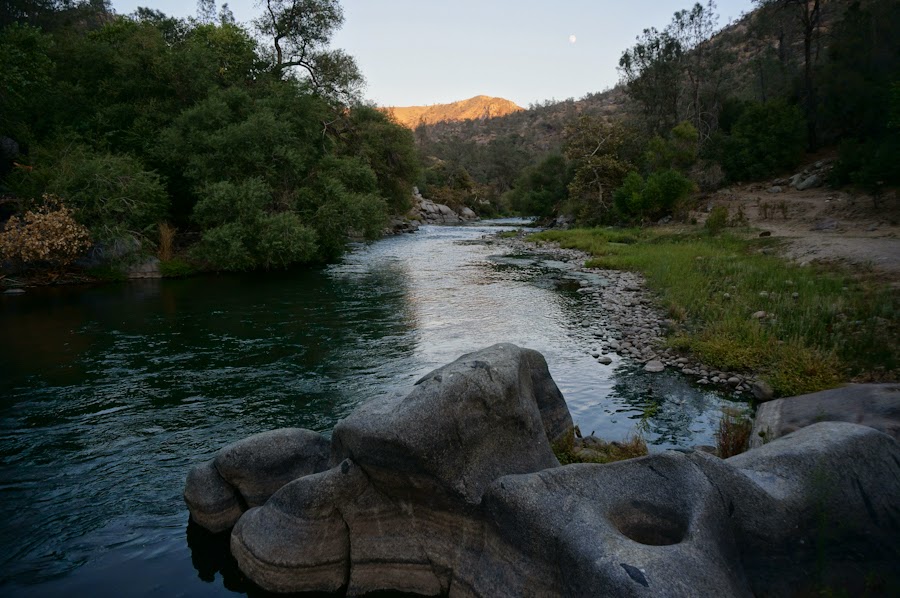
mellow path in idyllic kern canyon

Does a bear shit in the woods?  Yes.
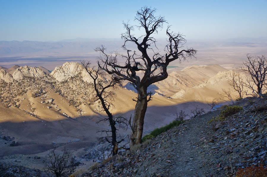
crazy-lookin' tree

Although the clouds were rolling in, I held hope that it would suddenly clear up for a sunset view atop Franklin Pass.  

Instead I faced thick clouds with high freezing wind with hardly any visibility.  I was worried about losing the trail up top but managed to stay on the mountain and on the trial.

A hike isn't an adventure unless you add a harrowing moment.

Brrrr!  Frosty morning at Franklin Lake

Black bear near Mineral King trailhead

27 mile hike to Kern Canyon hot springs - 23 miles back to the car

11.12.2014

From Cottonwood Pass to Walker Pass & Remington Hot Springs

After leaving the crew of brothers and friends behind, the PCT south of Mt. Whitney became sandy, waterless and almost devoid of other humans.  Almost all water sources were dried up.  I started leaving the trail to look for springs that were flowing earlier in the summer but had dried up in late August.  For the rest of my hike to Mexico, finding water to drink would be a major focus of my trip.

Colorful moss on rocks near Death Canyon Creek
After leaving the JMT section, the PCT also became more difficult to follow: confusing junctions with cow paths and broken trail signs laying on the ground.  I was glad that I had Half Mile's app to keep me on the trail.  Sagebrush in the day and coyote yelps at night became ubiquitous.  Although I was hiking on Labor Day, I saw 0 humans, 0 hikers. No weekend warriors chose to hike the section north of Kennedy Meadows for fun - at least not in the heat of early September.
Spring/trough near Beck Meadow

This is the South Fork of the Kern River near Kennedy Meadows...completely dried up.  In Yogi's guide, she says it's a great place to swim, but there was no water.

Tracks in the dry riverbed: evidence of California's drought.  In the High Sierras the water was so plentiful, but as soon as I entered the Southern Sierras, the landscape dried up.  I walked through the so-called Golden Trout Wilderness, but I don't know where there would be trout since there was hardly any flowing surface water.  I carried 6 liters of water leaving Kennedy Meadows.


I started figuring out that I needed to wake up super early, take a long rest in the middle of the day and hike at night to avoid the incredibly strong heat of midday. One day at a time. 

There was always beautiful sunsets and sunrises in the desert.


Looking east towards the desert

And the landscape started filling up with yucca, cacti and joshua trees.


Nearing Walker Pass

From Walker Pass, I was lucky enough to catch a Kern County bus at daybreak to travel 37 miles west to Lake Isabella for a resupply.  The bus only goes through 9 times a week and I got to the highway about 7 minutes before it came up to Walker Pass.  I then went further west (about 8 miles mostly on foot) to relax at Remington Hot Springs, where the Kern River was, thankfully, flowing strong.  The hot springs were hopping for the weekend and I met lots of wonderful and generous people.
Remington Hot Springs